By Timo Luege, TC103: Tech Tools and Skills for Emergency Management facilitator
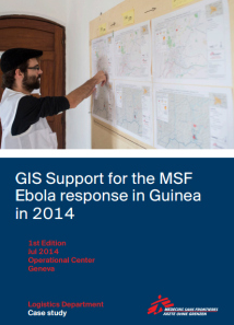
As technology for disaster response evolves, digital mapping is playing an increasingly important role in helping emergency managers in humanitarian emergency response operations. When considering the best tools and skills to respond to the Ebola crisis in West Africa, earlier this year, Doctors without Borders/Médecins Sans Frontières (MSF) sent a dedicated Geographic Information Systems (GIS) officer to Guinea, to support the local and international medical teams who are fighting the Ebola-outbreak. To find out whether that was a good investment, the MSF GIS Unit asked TC103 facilitator Timo Luege to write a case study showing the impact of this field-based GIS officer.
Some of the key observations are:
-
Most of the the areas close to the border of Guinea, Liberia and Sierra Leone had not been mapped previously. This meant that it was very easy to see the changes.
-
Despite being in a very remote area, the GIS officer had decent internet connection which allowed him to reach out for remote support. Among other things this made it possible for the volunteers of the OpenStreetMap community to contribute directly to supporting the response. So this is also a case that shows what crowdsourcing can contribute to humanitarian emergency response.
-
Since the GIS Officer was in the field, he and his local staff were able to provide context to the basemaps that were produced remotely. Both components were important: without the remote support, the GIS wouldn’t have been able to create all basemaps at the granularity that is available now. But without the GIS in the field, a lot of the traced outlines would not have been meaningful, because you need local knowledge to know whether a building is a school, a hospital, a police station etc. Also: assigning the correct names to villages is at least as important as mapping roads. Again, you need people in the field to do this.
-
Because MSF chose to use formats and tools that encourage or even require sharing, many maps created for MSF will add value to local communities, local government and help other humanitarian and development organizations working in the area. This means that the outputs will continue to be beneficial and can be built upon.
You can download the complete case study here:
“GIS Support for the MSF Ebola response in Guinea in 2014”
This post originally appeared in Social Media for Good
Interested in learning more on how to use digital crisis mapping tools for humanitarian emergencies and natural disasters? Enroll now in this online course on Mapping for International Development and Tech Tools & Skills for Emergency Management.
About the TC 103 facilitator: Timo Luege
After nearly ten years of working as a journalist (online, print and radio), Timo worked four years as a Senior Communications Officer for the International Federation of Red Cross and Red Crescent Societies (IFRC) in Geneva and Haiti. During this time he also launched the IFRC’s social media activities and wrote the IFRC social media staff guidelines. He then worked as Protection Delegate for International Committee of the Red Cross (ICRC) in Liberia before starting to work as a consultant. His clients include UN agencies and NGOs. Among other things, he wrote the UNICEF “Social Media in Emergency Guidelines” and contributed to UNOCHA’s “Humanitarianism in the Network Age”. Over the last year, Timo advised UNHCR- and IFRC-led Shelter Clusters in Myanmar, Mali and most recently the Philippines on Communication and Advocacy. He blogs at Social Media for Good and is the facilitator for the TechChange online course, “Tech Tools & Skills for Emergency Management“.


