As K-12 teachers experiment with iPads in the classroom, Twitter streams in the backchannel, and TEDtalks as the new textbook, university professors are figuring out what to make of massively open online courses and how it will affect their classroom. After reading the barrage of stories this past year on new innovations in education technology, from the flipped classroom to edX, I began to wonder why K-12 teachers reported feeling empowered by the new technologies while massive open online courses (MOOCs) seemed to pose a threat to all private higher education institutions that’s so indecipherable most are unsure how to react. Why were stories on the flipped university classroom so rare this past year? With our upcoming course on Social Media and Technology Tools for Research in mind, we wanted to find a model that was actually leveraging tech tools in a way that was improving higher education learning on a broad scale.
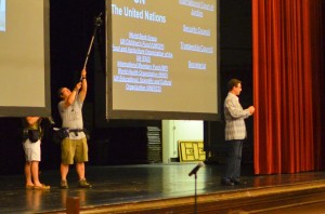
We found Dr. John Boyer of Virginia Tech, who has been innovating and enlarging his World Regions classroom for the past decade. When he started he was in a classroom of 50 students using an inherited world regions textbook that leaned heavily on Western history. Now he is in a 3,000 seat auditorium, using the 6th edition of his own textbook and a companion website for digital and social media content that more than twenty other universities have adopted. We came across him in the same way that many have–through his plea to Aung San Suu Kyi for a Skype interview (which she agreed to) and the ensuing visits from Martin Sheen, Emilio Estevez, and Invisible Children’s Jason Russell. “We hope to have President Obama visit, which would make a lot of sense for him. Why wouldn’t he want to have 3,000 screaming university students tweeting and facebooking his interview?” He told me that those celebrity visits are not planned in the syllabus but come about organically, which also reflects the nature in which he adopts technology into the classroom. From my chat with him I gleaned three questions for university educators to ask themselves as they adapt hybrid classroom methodologies.
1. Will it improve communication between the professor and students?
Effective teaching depends on the way that information is communicated to the learner. Professor Boyer literally brings his curriculum to the fingertips of his 3,000 students on his website, plaidavenger.com. While his textbook may cover very recent issues in its sixth edition, the website covers global news and issues of the week. Students can easily scan video interviews, articles, and twitter streams and they can earn credit by participating in class dialogue over social media networks.
In a class of 3,000, students can easily feel distanced from their professor, but his online office hours and regular availability on Twitter and Facebook provides a safety net of communication. In my worry that he was online all day and night communicating with students he reassured me, “just a very small percentage actually use it and having the safety net of knowing it’s there satisfies the rest.”
2. Is tech interaction built into the syllabus?
As opposed to traditional pedagogies where students start out with an A and then lose points as they respond incorrectly, his students start with nothing and are rewarded for each activity they complete. Grades are determined by gross point accumulation and students can choose the way they want to earn those points. They can go the traditional route and take standard tests, fill out atlas quizzes, and write papers, or they can earn it through interacting with world leaders on Twitter, commenting in global news reports, or listening to podcasts.
According to an article in The Atlantic, flipping the learning model in the university setting in this manner leads to more personalization of the learning process. Professor Boyer’s exemplifies this by allowing the student to choose the assignments (not a single one is required, not even tests) that fit their learning method best. From the start of the semester, students have the flexibility and the accountability to complete the class how they want to.
3. Am I offering technology that students already use or can easily start using?
Virginia Tech is not only at the fringe of the flipping the university classroom, but physically it’s at the fringe of an urban-rural divide. Located in Blacksburg, Virginia, 60% of the town’s 42,000 are students and many come from rural communities. Students may not be used to many of the newest apps or devices. “I would love to start using foursquare to have students check in for attendance but I’m pretty sure only 1% of my students even know what it is,” Dr. Boyer told me. Despite some limitations, he is able to use quite a diverse tech toolset in his class. He uses (most links go to the unique class page) Delicious for bookmarking articles, online discussion forums on the class page, international movies, iTunes U, Skype, UStream for online office hours, Turntable.fm for their class international playlist, and one of my favorites, PollEverywhere, is used to instantly poll to students on what they want to learn that day. These tools offer a plethora of options rather than required tools to use so that the students can involve themselves in the way they like.
Each of these questions asks what kind of options do the students have to learn the material and how they will be awarded for it. The hybrid classroom puts more accountability on the student to take the time to learn the subject matter, but also allows them the freedom to choose how they want to learn it. Dr. Boyer is evolving his classroom depending on the way that his students use technology and not the other way around. It won’t be long until university students are expecting the hybrid “flipped classroom” experience, especially when they have come from high schools that have already been implementing it.
If you are interested in international peacekeeping, consider taking our next course, Social Media and Technology Tools for Research, starting Monday, August 20th.
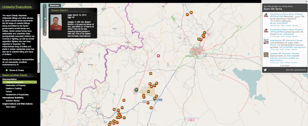
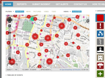 But the tools are only part of the story, now that disaster responders can tap into networked communities of interest that can help process massive quantities of data in a timely manner. The most obvious example of this is Ushahidi, which rose to the forefront due to its Haiti earthquake response. Ushahidi Trusted Developer John Etherton will talk about how technologists can design and adapt technology to empower crowds to make a difference. But crowdmappers need help and protection too — legal liability expert Ed Robson will talk about how networks like Crisis Mappers and Standby Task Force can protect themselves from legal liability in this developing space.
