Image source: ReadyMarin
During an emergency, it is important to have ample information. Specifically, emergency management teams and affected populations need details surrounding the what, where, when, and how – as well as instructions for how – to respond, and communicate with coworkers and/or loved ones. While it is best to have a plan in place that includes how to receive this information with emergency kits and communication plans, it can be easy to forget to keep these plans up to date, practice them, or finalize them once started. On top of this challenge, the rapid lifestyle of professionals and the over-sharing of information through technology can lead to a very reactive and possibly dangerous outcome during a crisis.
The United States, like many societies, has become increasingly attached and sometimes dependent upon mobile technology and smartphones. Knowing this, how can we use this technology to stay better informed, to communicate better, establish better emergency planning, and stay calmer during times of crisis? Along with information on the importance of having and practicing emergency plans and building emergency kits, the Red Cross and the Federal Emergency Management Agency (FEMA) have used mobile technology by creating a number of mobile apps to help civilians administer First Aid, find shelter, and donate blood.
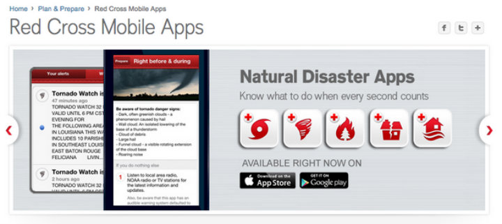
The Red Cross labels most of their apps under “Natural Disaster,” to provide emergency information and alerts through reliable sources including the National Oceanic and Atmospheric Administration, and the United States Geological Survey, which provide instructions before/during/after the event, locate warnings based upon your area, and a number of other life saving and calming features. The Red Cross has separate apps for each disaster:
- Tornado
- Wildfire
- Earthquake
- Hurricane
- Flood
- Shelter Finder
The purpose of these separate apps is most likely to ensure users are getting the most up-to-date information as well as maintain accurate warnings and communication. However, managing these distinct apps might be irritating for users that live in an area that usually experiences more than one of the listed disasters. After installation, users are able to set up alerts to have their phone directly notify them of any warnings in their area. Two of the most helpful apps allow users to find shelters in their area and an “I’m Safe” alert. Shelter Finder allows users to locate open shelters, and view capacity, all using data from the American Red Cross National Shelter System, which often assists FEMA. Shelter Finder also contains information on 60,000 potential disaster facilities, and is updated every 30 minutes. “I’m Safe” is a customizable alert that connects to social media, and notifies friends and family on location and status. The Red Cross also suggests using their Safe and Well website or call 1.800.RED.CROSS, where individuals can register their status and location, and search for loved ones.
One of the key components to the Red Cross Emergency Apps is the dependence on phones lines and connectivity, which are often down or slow during times of crisis. Therefore it is suggested that family members have other plans in place including designated shelter locations.
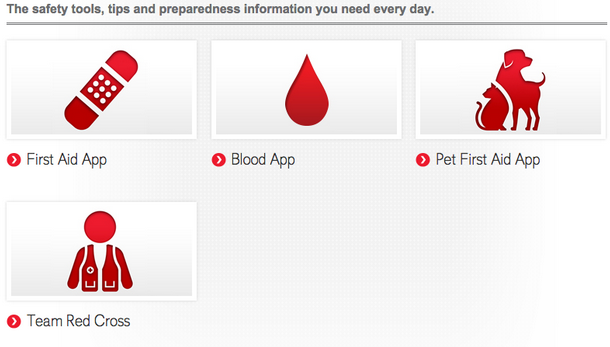
Alongside the emergency apps, the Red Cross has also developed a number of everyday apps:
- Blood: The first of its kind, makes giving blood convenient and allows users to find local blood drives and book appointments through the app, in addition to sending out blood
- shortage alert messages during emergencies.
- First Aid: Provides pre-loading offline instructions to guide you through first aid scenes
- anywhere, integration and ability to call 911 from the app, safety tips, and educational
- games.
- Pet First Aid
- Team Red Cross Volunteer
- Swim

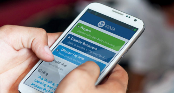
FEMA mobile app
If users are looking for a more centralized emergency app, then definitely download FEMA’s mobile app; providing disaster safety tips, emergency meeting locations, information on open shelters and FEMA Disaster Recovery Centers, and the ability to use GPS to report and photograph disasters that are displayed on a public map. For non-smartphone users, FEMA also has a text message feature where users can receive safety tips for disasters and search for open shelters by texting 4FEMA.
Both organizations make it easy to streamline warnings, access vital information, and other
important alerts during an emergency. Mobile tools and apps allow even the busiest and
underprepared to have information readily available to them, and is definitely something that is recommended for everyone to have on his or her phone.
All Red Cross apps are available for download through the Apple Store and Google Play, in both English and Spanish. For more information on the Red Cross Plan & Prepare apps and more emergency planning materials visit: http://www.redcross.org/prepare/mobile-apps
For more information on FEMA’s Mobile App, Text Message Alerts, and more visit:
https://www.fema.gov/mobile-app
Interested in learning more about technology tools for emergency management and disaster response? Register now for our Technology for Disaster Response online course which begins next week on June 22, 2015.
Alumni bio:
Megan Penn is completing her second year in the MA Security Policy Studies program at the George Washington University, Elliott School of International Affairs in Washington, DC. There, she is concentrating on Transnational Security Issues and Cyber Security Policy, with focus on human security, organized criminal activity, human trafficking, international institutions, and cyber security and information operations. While in classes, Megan has interned at a private aviation company, and currently works for a business development firm and writes for Freedom Observatory. Before DC, Megan completed a Bilingual Honours BA in International Studies at York University – Glendon College, in Toronto, Ontario. You can connect with Megan on LinkedIn.


